Year 3 -14 June 2026 -Arrival– La Reunion
I woke about 4.00am as Stormbird had slowed even further and I could sense it. I got up and Carolyn and Joyce were on and I suggested we shake out the reef on the genoa and tighten in the main as we were now 50 degrees off the wind rather than 90. However, the wind died even further and we were only 11nm to our waypoint.
When John and I came on watch early we put in the sails and motored about 5-6 kts slowly as we did not want to get to Le Port or Port Quest as they call it too early.
We could clearly see the lights twinkling on the island and you could see the lights going up the hills but we could not see the hills yet. There was a line of red lights which ran up one hill in a sequence and I wondered whether it was guidance for aircraft or perhaps a chair lift. It had been amazing that we had seen the lights of the island so far off-some 55 nm.
We motored on and saw very little traffic. I called Reunion on the radio and reported our intensions and they thanked us for our report and authorised us to continue to Port Quest.
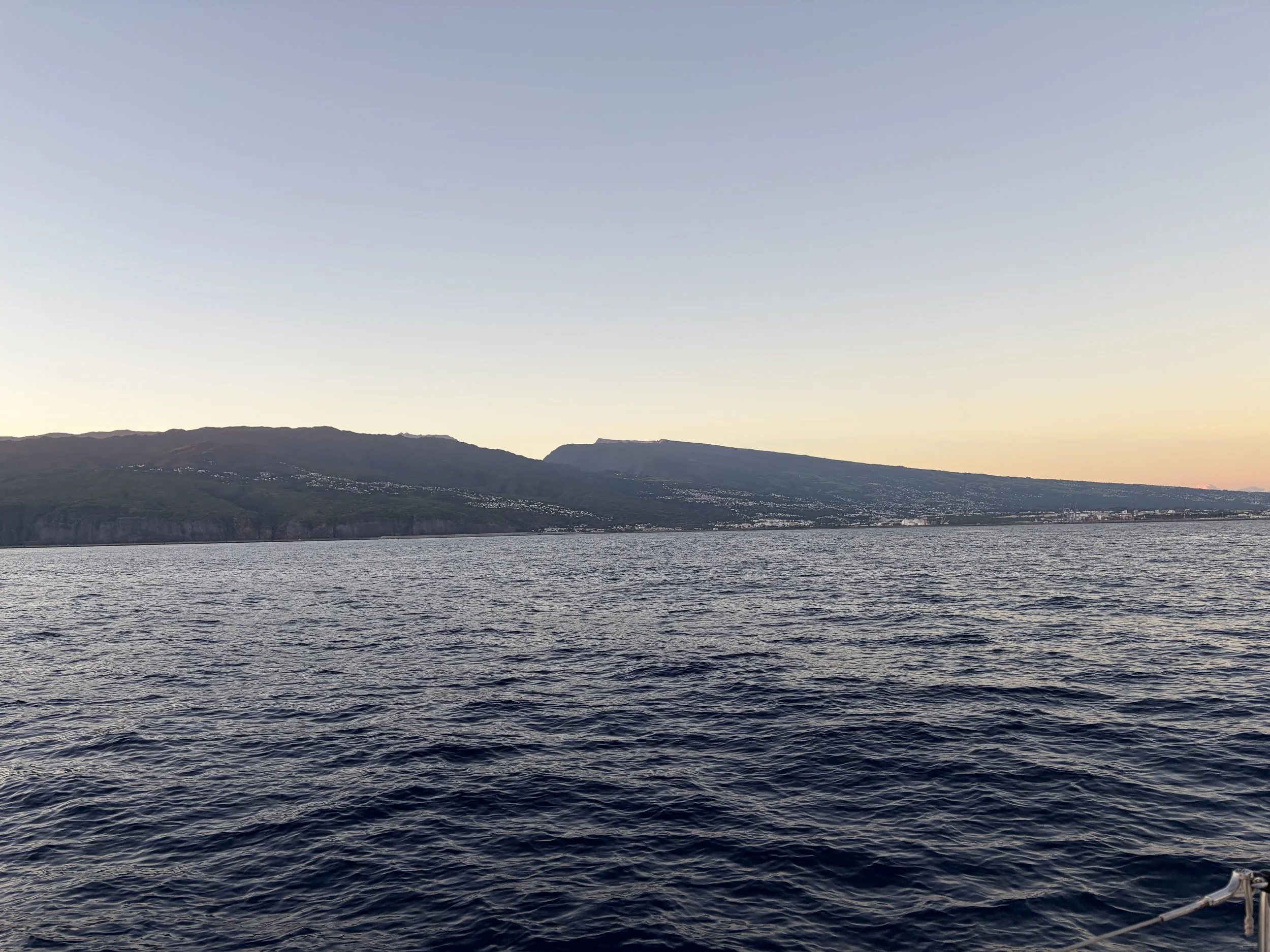
The light began to come up about 6.00am and we could then see a little more of the island with its mountainous middle and slowly inclining hills rising from the sea. We could see the ring road on stilts on the edge of the cliff.
Route nationale 1 is a major highway on the island of Réunion. It links the communes of Saint-Denis and Saint-Pierre, and passes through all of the communes on the island's west coast. The Pointe des Aigrettes, Réunion's westernmost point, may be found along this road. However, building a 12.4km road above the Indian Ocean was also a major technical feat. Pile foundations for the viaduct were built in waters that were up to 12 metres deep. The engineering team also had to factor in the viaduct’s exposure to extreme weather, cyclonic swells and abrasive saltwater. It also had to comply with the highest environmental standards and minimise disruption to underwater ecosystems. The New Coastal Road comprises more than 8,200m of viaduct and 4,200m of causeway, plus new road junctions. This highly complex project involved a wide range of technical disciplines, with much of the original design carried out with Building Information Modelling and a specialised hydraulic laboratory.
The causeway is one of the largest civil engineering structures ever designed in this field. It consists of a core of submerged rockfill material, a sunken abutment, a concrete block armour, a sea-proof retaining wall and rockfall protection.
Likewise, the viaduct required deep technical expertise. Immersed in up to 12 metres of water, the deck of the viaduct carries 2 x 3 lanes and can be adapted to include a tramway in future. The decks, 29 m wide, are of the prestressed caisson type, with variable or constant height depending on the case.
To erect the first viaduct, 5,400 m long and 20-30 m above sea level, they used a mega-barge and a 278m launching beam, weighing 2500 tons, to lay the 1176 segments of the deck.
The New Coastal Road, , also known as the Route du Littoral (RN1), is a highway which was under construction since the end of 2013. The road connects the coastal cities of Saint-Denis and La Possession. This road, known as the world's most expensive road, is very particular because it is built on the sea. The 12.5 km (7.8 mi) road, comprises three main components:
· a 5.4 km (3.4 mi) viaduct, which is located 70 m (230 ft) offshore and 20–30 m (66–98 ft) above the ocean, between Saint-Denis and La Grande Chaloupe;
· a 3.6 km (2.2 mi) causeway between La Grande Chaloupe and La Possession;
· an interchange at La Possession connecting the causeway to the existing road network.
Carried by a set of viaducts and dykes, this road was reclaimed from the sea and a dozen kilometres linked Saint-Denis to La Possession by replacing then coastal road, too exposed to the scree of the cliff at the foot of which it is located and to cyclonic and southern swells. In doing so, it constituted part of the national road 1. This project raised many technical, ecological, and financial problems, and the award of some of the contracts is the subject of a judicial investigation.
The cost of the project was funded to the tune of €1.6 billion (base December 2011), or €130 million per kilometre, compared to the €6 million required on average for a kilometre of motorway in the countryside.
RN1 is featured in "A Massive Hunt", the second episode of the fourth series of The Grand Tour- which was formed after Top Gear finished.
We motored on and it was soon light and we could see the island in clear daylight and saw the hills rising from the sea and peaks at considerable heights. We came to the entrance to the port and called Port Control to ask permission to enter. This was given but as we did so a large ship was coming out so we turned around and waited for it to leave and then went in. We had an allocated berth against a wall and we had to enter a small channel to get there. However, luckily there was a long pontoon against the wall which was only out in last year. We reversed in and were met by the lady in charge of the marina. She was very welcoming and gave us all sorts of information and settled us into our spot. We had travelled 138nm from Mauritius.
We sorted ourselves out and plugged into the electrics. The customs and immigration people came and cleared us in and stamped our passports.
When we were ready Hisham, Keith, John and I decided to walk into town to find a bar. We walked round the marina and found a sign in the marina warning us of sharks.
There is a list of fatal shark attacks in Reunion. Réunion is an overseas department and region of France and an island in the Indian Ocean with over 207 km (128 miles) of coastline and hundreds of public and private beaches.
As of late 2018 there have been 27 fatal attacks and 56 total attacks since 1913. The island was the locale for over 16% of the world's fatal attacks from 2011 to 2016. The reason for the frequency of fatal attacks has to do with the island's tropical location. The island is situated in a so-called "shark highway" between Australia and South Africa, two countries with shark dominated waters. Many large sharks who use this shark highway find Réunion home due to its diverse aquatic ecosystem and coral reefs, offering sharks a thriving home.
A study released in 2015 showed Réunion had recorded a remarkable 3.15 shark-related deaths per one million people, by far the highest in the world. The next highest rating was that of South Africa, with 0.76 per one million residents, while the United States had a rate of 0.0013 per million.
I shall not be swimming here.
It was a 25 minute walk and very little was open. We found one bar and a takeaway Chinese stall where you could eat at plastic tables. We had some food ( as that was all there was) and then walked back to Stormbird. It was very hot and still and we had a cold beer when we got back.
We rested and chatted and Carolyn and Joyce decided to have the mince we had cooked from the freezer with mashed potato and the rest cheese and biscuits.
We had had a good day on the whole in that we had arrived and could look forward to a day of exploring more tomorrow when things are open.
The picture of the day is one of our first views of Reunion.
Need/Opportunity Year Three
I am now in Mauritius and will be going to Reunion, Cape Town, St Helena, Azores and back to the UK.
I have now found additional crew for Mauritius to Durban. There may be space from Durban to Cape Town from about the beginning of July and we should arrive in Cape Town on about 25-30 July 2026. If at all interested contact me on my email below or WhatsApp +44 7931360372.
The blog will continue as we continue the journey. If you have any comments or suggestions about the blog then do email me on hine.nick9@gmail.com