Year 3 -3rd September 2026 -Departure from St Helena- Cape Verde -Day 1
It was a bit brighter when we woke and as we were leaving it was typical that this was the best morning so far. We had breakfast and began our preparations.
Paul did a deck walk to check everything and I went through the engine room. All was good but I topped up the coolant for the generator. The main block attaching the mainsheet to the boom needed Monel wiring (so the shackle cannot come loose and fall off) and this was done.
The Blue Baron needed to be tied down better and some sheets were twisted and so we sorted all that out.
We had breakfast but we had not been able to get much in the way of fruit in St Helena. We therefore had a few papayas but otherwise we can only have one piece of fruit per person per day.
Mark and I went ashore at 8.30am and Mark was dropped off at the jetty and I was taken round the corner to Rupert’s Bay. I walked to Port Control, paid their fee and obtained clearance to leave. I then had to go to Customs and Immigration and get our passports stamped and exit documentation (this is always required for your next destination). I then walked back and caught the ferry back to Stormbird. Mark was to repay Sally Ann of the Standard Pub and to meet Derek and Linda who were kingly bringing the last of the provisions and washing. Mark tried to get some fruit and bananas but to no avail.
Mark returned when he was finished and we had prepared the boat ready for departure. Once everything was stowed away we all gathered in the cockpit and then I went through our emergency procedures and asked where various things were stored, so we got our minds back into passage mode and safety. We talked about the starting weather and route etc.
The passage from St Helena to Cape Verde is just under 2,300nm and will take some 13-14 days. Our route takes us close to Ascension Island some 700nm North and then we head up above toward the Northwest edge of Africa keeping some 200nm off the African coast due to potential piracy. We will probably turn our AIS off in that area so we can run silent. We will have to pass through the ICTZ zone -called the Doldrums which is likely to mean we may not have much or any wind as it is close to the Equator.
The Intertropical Convergence Zone, known by sailors as the doldrums or the calms because of its monotonous windless weather, is the area where the northeast and the southeast trade winds converge. It encircles the Earth near the thermal equator, though its specific position varies seasonally. When it lies near the geographic equator, it is called the near-equatorial trough. Where the ITCZ is drawn into and merges with a monsoonal circulation, it is sometimes referred to as a monsoon trough (a usage that is more common in Australia and parts of Asia). The ITCZ appears as a band of clouds, typically thunderstorms, that encircle the globe near the Equator. In the Northern Hemisphere, the trade winds move in a southwestward direction from the northeast, while in the Southern Hemisphere, they move northwestward from the southeast. When the ITCZ is positioned north or south of the Equator, these directions change according to the Coriolis effect imparted by Earth's rotation. For instance, when the ITCZ is situated north of the Equator, the southeast trade wind changes to a southwest wind as it crosses the Equator. The ITCZ is formed by vertical motion largely appearing as convective activity of thunderstorms driven by solar heating, which effectively draw air in; these are the trade winds. The ITCZ is effectively a tracer of the ascending branch of the Hadley cell and is wet. The dry descending branch is the horse latitudes.
The location of the ITCZ gradually varies with the seasons, roughly corresponding with the location of the thermal equator. As the heat capacity of the oceans is greater than air over land, migration is more prominent over land. Over the oceans, where the convergence zone is better defined, the seasonal cycle is more subtle, as the convection is constrained by the distribution of ocean temperatures. Sometimes, a double ITCZ forms, with one located north and another south of the Equator, one of which is usually stronger than the other. When this occurs, a narrow ridge of high-pressure forms between the two convergence zones. In the Age of Sail, to find oneself becalmed in this region in a hot and muggy climate could mean death when wind was the only effective way to propel ships across the ocean. Calm periods within the doldrums could strand ships for days or weeks. Even today, leisure and competitive sailors attempt to cross the zone as quickly as possible as the erratic weather and wind patterns may cause unexpected delays.
In 2009, thunderstorms along the Intertropical Convergence Zone played a role in the loss of Air France Flight 447, which crashed while flying from Rio de Janeiro–Galeão International Airport to Charles de Gaulle Airport near Paris. The aircraft crashed with no survivors while flying through a series of large ITCZ thunderstorms, and ice forming rapidly on airspeed sensors was the precipitating cause for a cascade of human errors which ultimately doomed the flight. Most aircraft flying these routes are able to avoid the larger convective cells without incident.
Once we are through the ITCZ we can move on up to Sao Vicente being the island in Cape Verde where we are most likely to stop to refuel and re-provision. The marina is called Mindelo as is the town and Mark and I came here in 2019 when we did the ARC Plus on my previous boat Luce di Mare -a Hallberg Rassy 412. This was when we crossed the Atlantic for the first time.
Once we had done the briefing and we were ready to go Mark, John and Dave went to bring up the anchor, Our instruments and engine went on and within a few minutes we had upped the anchor and began to motor out of the harbour. I had set our first waypoint some 400+ nm away on a bearing of about 333. We were initially in the lee of the island so we continued to motor until the wind settled and I also needed to charge the batteries.
After about 5 nm the wind had settled and we put up the main with one reef and the genoa reefed to the Doyle sign as the wind was gusting up to 25 kts. It was coming from the ESE so we could sail on a broad reach. We looked back on the island and the sun lit up Jamestown and its coast but the cloud and mist stubbornly refused to leave its top. As we continued the island shape began to fade and to merge with the grey clouds.
We sailed on and were having a good start doing 8+ kts but there were some small rain clouds around. Julian and I were on the first watch and we agreed to go on until 4.00pm meaning we did over 5.5 hours. We dealt with a least 3-4 of these rain clouds, some of which went parallel down our Starboard side or wet us as it came past our stern. They were not heavy rain clouds but provided some wet drizzly rain for a few minutes but also increased the wind by about 5 kts.
We eventually shook out the reef in the main and genoa and sailed on well and eventually the island disappeared from our view altogether. It has been a most interesting visit but it is probably unlikely that we will return again- but you never know.
Derek and Linda had given us some hard cakes to have and some tuna fishcakes with a tomato salsa. We had a hard cake shortly after we got going which was a nice treat to start. Mark prepared some coleslaw and salad and we had the fishcakes and tomato salsa for lunch and it was a great first lunch of this trip. Derek and Linda was so kind and hospitable and proved that the Saints are very welcoming and friendly.
The afternoon continued with grey cloud, reasonable winds and the odd bit of drizzle but every mile brings us closer to the Equator and warmer weather. Julian and I handed over to Mark and Dave who had to reef at one point due to a large rain cloud. John meanwhile was preparing his chicken and chorizo dish for supper.
I tried to have a rest but found it difficult. Others read and chatted or rested. John gave us supper about 6.45pm which was delicious and had a rich chorizo sauce and broccoli as our vegetable – which had lasted since Cape Town which was good.
Paul and John took over at 8.00pm and the rest rested and it was now very dark with thick cloud cover and no moon or stars. The drizzle continued and the wind varied by 15-20 degrees and also in terms of strength from 12 kts to 24.
Julian and I took over at 11.00pm and it really is a dark night. We seem to have all settled into the routine quickly and are now set for the night. Let’s hope the wind continues to be in the 15-20 kt range so we can continue to make good progress. I hope it will be brighter and warmer tomorrow.
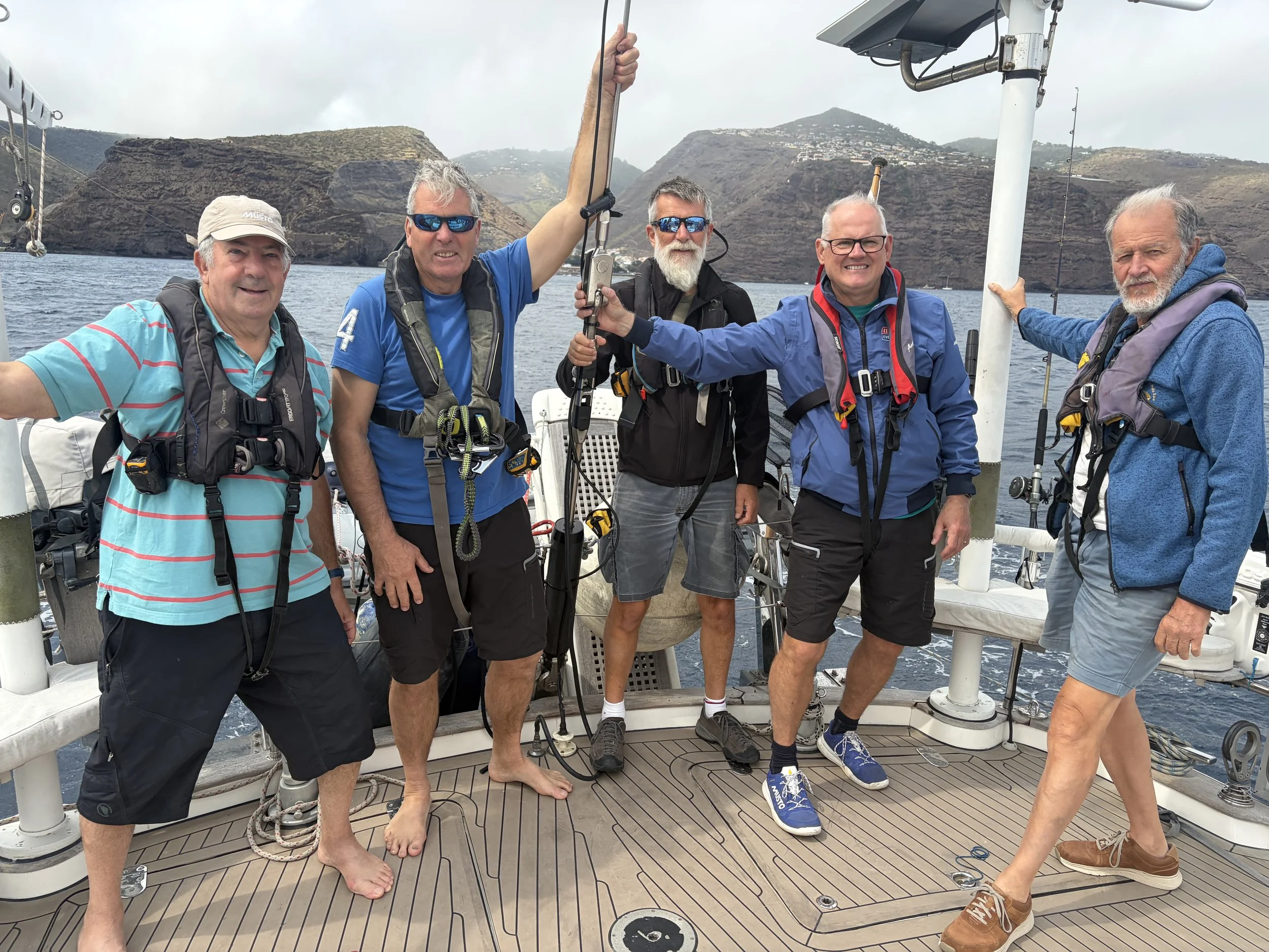
The picture of the day is of 5 of us saying goodbye to St Helena.
Need/Opportunity Year Three
I am now on the way to St Helena, Cape Verde, Azores and back to the UK.
The blog will continue as we continue the journey. If you have any comments or suggestions about the blog then do email me on hine.nick9@gmail.com