Year 2- 8 September 2025 –Bima on Sumbawa to Kanaga on Sumbawa
We woke at 5.30am and then had some tea and prepared to leave. The sun had not come up yet but there was some light. We upped the anchor with our navigation lights on. We then motored out of the bay and into the central channel. There was little breeze but we motored on and it began to get lighter and then the sun popped up from behind a hill and radiated light across the inlet. It felt good to be alive. There were a few long boats around fishing early and people going about their daily business.
We motored on and left the still cargo ships and port behind. We then motored through the zig zag channel waving at the fishing boats as we went past. As we came through the zig zags we could see a fleet of long boats all together fishing. It must be a hard life out here trying to catch fish each day for their families. We thought there should be quite a few brits who should come here to see what life is like rather than relying on benefits as there is none of that here.
We continued to motor on and once out the zig zag we continued out of the large bay and over to the West side of it. We saw the odd long boat and then a sort of Indonesian Cargo ship which looked what I think Noah’s Ark would look like. Once we passed this boat we upped sail and headed further out the bay. The wind strength was good and we made good progress. However, as exited the bay the wind died and we had to motor on again. The day was at bit on and off. We would sometimes have reasonable wind and sail and then it would die or go in the wrong direction. It seemed that the forecast direction and strength were wrong again. The issue for us was that if we wanted to get into our anchorage at Kananga before dark which was a 70nm trip then we needed to keep the miles up.
We would try and sail for a bit and then have to stop as the wind dropped or we were not going fast enough to get to our destination on time. The weather was nice and so we were comfortable. There were a number of cargo ships and passenger ships passing up and down the coast and a yacht not on AIS which sailed and went round the land contour.
We did an hour on and an hour off as shifts. In my time off I was doing emails and thinking about my best man’s speech for my brother’s wedding which is at the end of this month. Do not worry J they will be splitting their sides or cringing!!
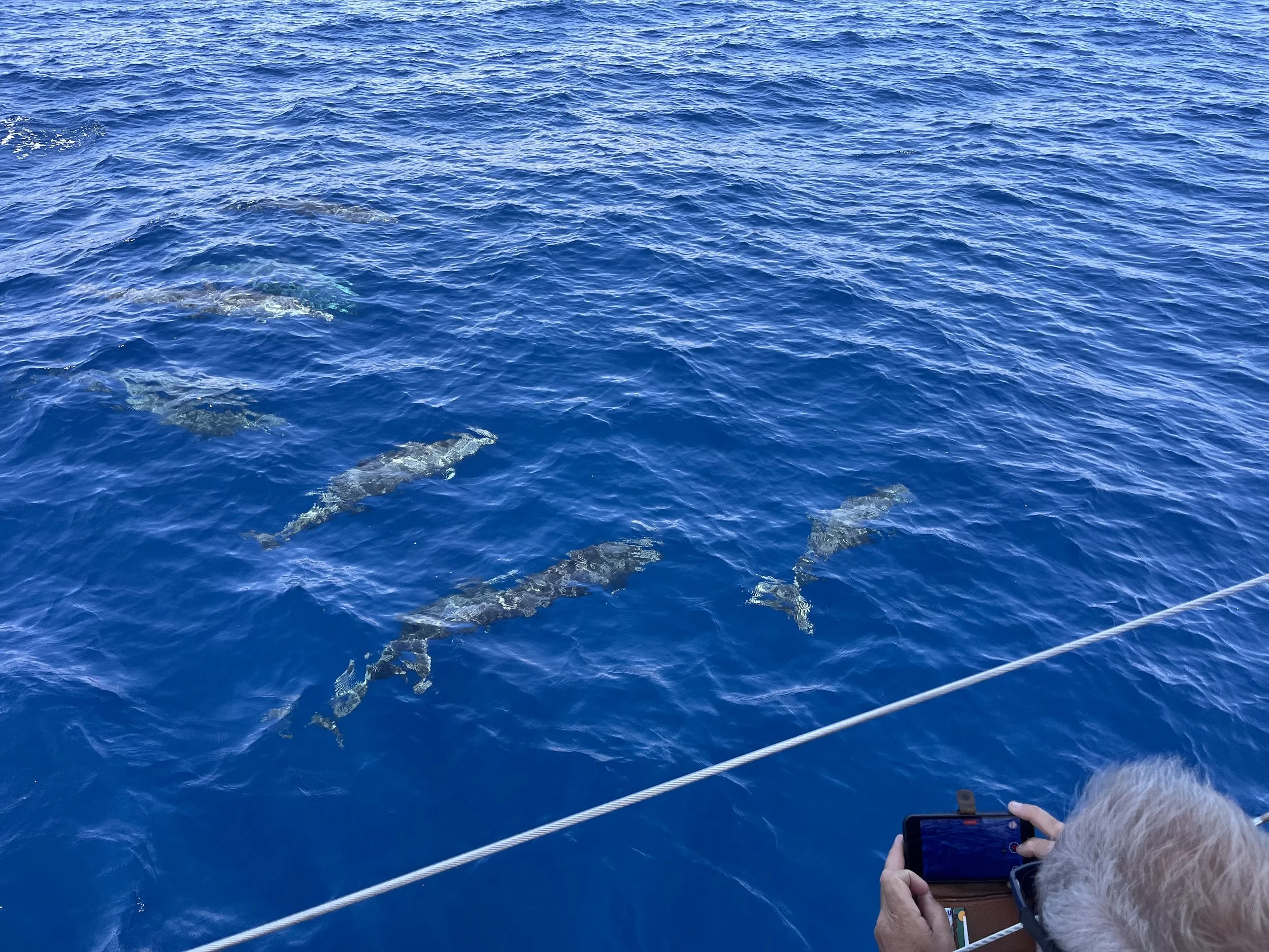
We saw a nice pod of dolphins who came to say hello and looked us up and down and swam round us and then swam off which was a good experience. Otherwise there were a few birds here and there but we saw no other wildlife. We therefore unfortunately had to motor most of the day with the odd few hours of sailing. Over the day I had drafted my best man’s speech and we managed to get to our anchorage off Kanaga Village for about 4.30pm. Enroute we could see Mount Tombora, a large former volcano which loomed up over the Island of Sumbawa.
Mount Tambora, or Tomboro, is an active stratovolcano in West Nusa Tenggara, Indonesia. Located on Sumbawa in the Lesser Sunda Islands, it was formed by the Mactive subduction zones beneath it. Before the 1815 eruption, its elevation reached more than 4,300 metres (14,100 feet) high, making it one of the tallest peaks in the Indonesian archipelago.
Tambora underwent a series of violent eruptions, beginning on 5 April 1815, and culminating in the largest eruption in recorded human history and the largest of the Holocene (10,000 years ago to present). The magma chamber under Tambora had been drained by previous eruptions and lay dormant for several centuries as it refilled. Volcanic activity reached a peak that year, culminating in an explosive eruption that was heard on Sumatra island, more than 2,600 kilometres (1,600 mi) away and possibly over 3,350 kilometres (2,080 mi) away in Thailand and Laos. Heavy volcanic ash rains were observed as far away as Borneo, Sulawesi, Java, and Maluku islands, and the maximum elevation of Tambora was reduced from about 4,300 to 2,850 metres (14,110 to 9,350 feet). Estimates vary, but the death toll was at least 71,000 people. The eruption contributed to global climate anomalies in the following years, while 1816 became known as the "year without a summer" because of the effect on North American and European weather. In the Northern Hemisphere, crops failed and livestock died, resulting in the worst famine of the century.
We motored on and then at about 4.30pm we came to the anchorage opposite the village which had a black volcanic black beach. Opposite us was the Island of Satonde which is now a nature reserve which has a green saltwater lake in its centre and is apparently very beautiful and worth visiting. We intend to go there tomorrow.
When we arrived we put down the anchor in about 15m of water. We had to do this twice as it was slipping a little but we got it to hold. The sailing boat we saw earlier came into our anchorage as well a little later and waved hello. We had a well-earned beer and then chilled.
I had taken chicken out the freezer and then made a chicken curry which we had with rice and red cabbage. It was good to be here and we will have a rest for a day or so.
The picture of the day is a picture of the dolphins coming to inspect us.
Need/Opportunity Year Three
In year three I will be going from Thailand to Sri Lanka, India, Maldives and then on to Chagos, Mauritius, Reunion, Cape Town, St Helena, Azores and back to the UK. I am looking for crew from Mauritius/ Reunion Island to Cape Town and from Cape Town to the UK. If of any interest do email me.
The blog will continue as we continue the journey. If you have any comments or suggestions about the blog then do email me on hine.nick9@gmail.com