Year 3 -6th September 2026 -St Helena- Cape Verde -Day 4
Julian and I came on at 2.00am and we were about 10nm off course as the winds had been light and we were trying to keep close to the wind to keep the speed up. The wind was about 10-11kts which was ok but at times it reduced to 7 and even 6 kts but luckily it picked up again. It was very dark and although the moon was supposedly out it was hidden by the blanket of cloud.
We went off at 5.00am and I woke about 8.00am. Some had cooked more bacon and egg as the smells lingered. I then cooked myself a bacon and egg sandwich. I also cut up some papaya as we need to eat it before it goes off.
I checked the weather and the model we had been following in Predict Wind -ECMWF suggested a bit of a change and so we changed to that course. Although this slowed us down a little we were following the model on which we rely to provide us the information to stay in the wind. It has proved to be good since Mauritius and so I am following it. We were making 6’s or 7’s which was fine. The 24hour run to 12.00noon was 161nm which reflects the lower wind strength.
Julian and I took over at 12.00noon and the wind began to pick up a little and we trimmed the Baron and we were soon making 7 + kts again.
Mark made some more coleslaw and tuna sweetcorn mayonnaise for lunch which we had with wraps and bread.
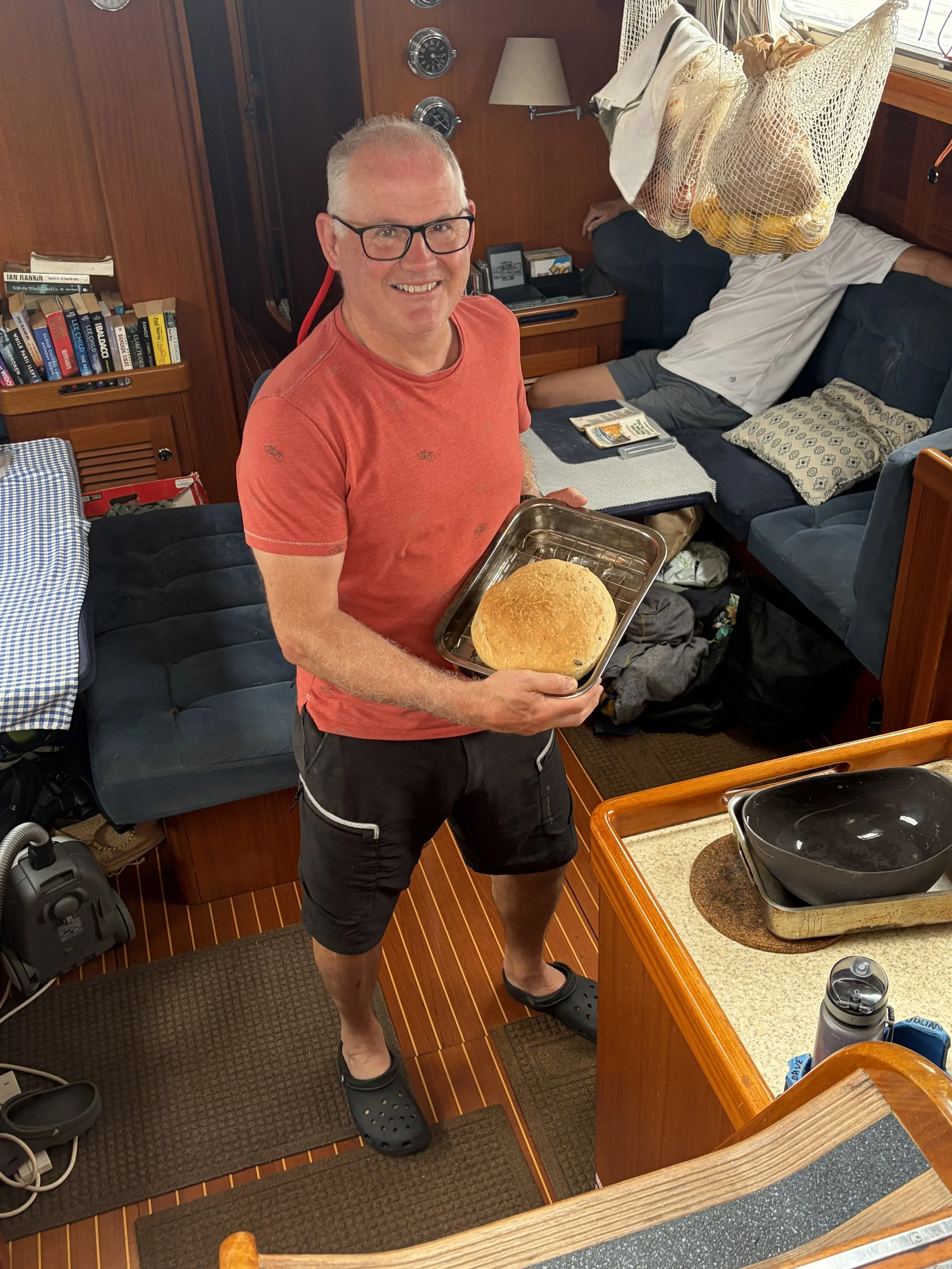
The afternoon wore on and Dave made a loaf of bread under Mark’s supervision which I am sure he would love to repeat at home! The sun tried to come out but the cloud cover was too much and it became quite muggy. Some slept, read or rested. The wind continued at a reasonable level and we were making 7 + kts which was good and quite comfortable.
I have come to reflect on our watches. I am now calling the watch which Mark and Dave have as the “Munchies”! We always find evidence after their watches of raids on the Naughty Cupboard – things left out, crumbs etc. Paul and John are the “Fiddlers” as they are always fiddling with the sails and direction. I do not know what they call Julian and I but I think we are the “Stabilizers” as we check the weather, set the course and stabilize the boat etc.
We are whizzing along and there is a lovely sound of the swish of the water as it passes down the side of the hull with the slight splash of the wake. The sea is vast and we have not really seen anything apart from the sea for days. We all got excited when a ship appeared on AIS but it was over 13nm away at its closest point to us and we could not see that far. We have done about 540nm since leaving St Helena as the crow flies and we have about 1,744nm odd to go. Quite a long way.
The wind picked up to 15-18 kts and we were soon doing about 9.5-10kts – a bit much but it soon calmed down to 13-15 again which is perfect and the Baron is pushing us along nicely.
The sunset was lovely as the sky had cleared and we watched the sun disappear below the horizon. John had made another chicken cacciatore which had a lot of flavour.
We settled down for another night in which we will pass Ascension Island.
Ascension Island is an isolated volcanic island, near 8° south of the Equator in the South Atlantic Ocean. It is about 960 miles (1,540 km) from the coast of Africa and 1,400 The island is the location of RAF Ascension Island, which is a Royal Air Force station, a European Space Agency rocket tracking station, a British-American signals intelligence facility and the BBC World Service Atlantic Relay Station. The island was used extensively as a staging point by the British military during the Falklands War. Ascension Island hosts one of four ground antennas that assist in the operation of the Global Positioning System (GPS) navigational system (the others are on Kwajalein Island, Diego Garcia, and Cape Canaveral). NASA operates a Meter Class Autonomous Telescope (MCAT) on Ascension Island for tracking orbital debris, which is potentially hazardous to operating spacecraft and astronauts, at a facility called the John Africano NASA/AFRL Orbital Debris Observatory.
The main island has an area of approximately 88 square kilometres (34 sq mi). A volcanic peak, Green Mountain, rises 859 metres (2,818 ft) above sea level from 100 kilometres (62 mi) west of the Mid-Atlantic Ridge. Much of the island is a wasteland of lava flows and cinder cones; forty-four distinct dormant craters have been identified.
The picture of the day is of Dave’s loaf of which he is very proud. There is just John and Paul who have to make one and then all of us will have done it. It is so nice to have a fresh loaf every day.
Need/Opportunity Year Three
I am now on the way to Cape Verde, Azores and back to the UK.
The blog will continue as we continue the journey. If you have any comments or suggestions about the blog then do email me on hine.nick9@gmail.com