Year 3 -17th September 2026 -Arrival in Mindelo - Cape Verde -Day 14
Julian and I took over at 5.00am from Paul and John and we were by this time motoring again toward our waypoint off Sao Vicente and we had about 2 hours to go. The guys had tried to sail in the night but the wind would come and go and change direction which made this difficult.
It was dark and somewhat hazy and we began to see the light on the Tower Machado which is 56m high flashing white every 4 seconds. In addition there was a red light on a rock pinnacle and 2 red lights leading to the runway on the airport which is this West side of the island. The dawn began to break at about 6.28am and we began to see more of the outline shape of the island with its craggy rocky volcanic outline. It became more evident as it got lighter and we reached our waypoint and began to make our way round the Western side of the island and on to its North coast. There was no traffic and we could see on AIS some ships in Mindelo Bay.
We entered the Canal Sao Vicente and had some current against us and the wind increase due to the channel between Sao Antao some 5 nm North.
We could see the rugged coast and peaks of hills and mountains. We could see on the chart the contour rings under water and how the island rises up from 4,000m to breaking out of the water to the height of 774 m which is its highest point.
We motored on and came into Mindelo Bay which had a number of tankers and cargo ships anchored. We picked our way through them and saw the town spread out across the bay and up the inclines of the slopes.
We motored slowly forward and I called up the Port Authority but they did not answer. I also called the marina with the same result. I knew where the fuel dock was as I had looked up the marina map. We therefore motored to this location and lines and fenders were put on the port side and we moored at the fuel dock. The marina staff had seen us and they said hello and would call the fuel man.
We had done it. We had travelled 2,369nm since St Helena in 13 days 21 hours and 26 minutes which is an average of roughly 7.1 kts. It felt good to be here and safe and sound.
The fuel man took about an hour and a half to arrive. However, we did not waste the time. Paul cooked an English breakfast which was welcome. The laundry lady came by and we agreed to get the laundry ready for collection by 10.30am. Another guy came by and offered his services so I got him to take the 2 empty gas cylinders to be filled and he returned them within the hour full. We started the grand tidy up and I had created a list of jobs to be done whilst on 3 watch and we eagerly started to tackle these jobs.
The fuel man came and we put in 546.69 lts into the tanks – so I had quite a lot left. This was good and we are now full again. I had been looking ahead at the weather to the Azores and we may have to motor for a few days as there looks like a wind hole mid
way.
Once paid we left the fuel berth and went alongside a pontoon. I had asked for this so we can get on and off at the side rather than the rear which has the dinghy etc on the back. I left the Motley Crew! to do the lines and fenders and to connect the electricity and to sort us out. I headed for the marina office and admin etc. I had to register and pay for cards which let us in and out. In addition each card has 100lts on it for showering etc. Water is all desalinated here. I had to nip to the cashpoint to get some money as they use Escudos here although Euros are accepted.
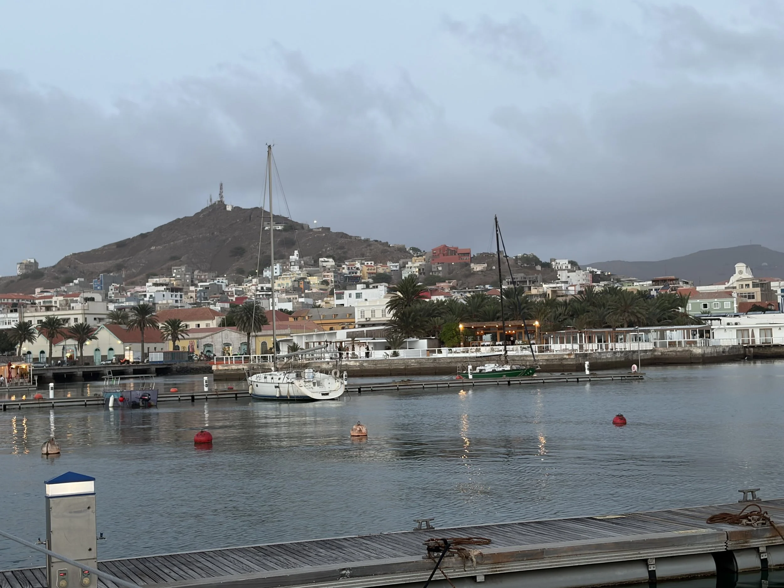
I looked around and the view from the marina gives you a good view of the town. There is a lot of new building going on by the ferry terminal and port. The main town is low level spread out round the bay with its sandy shore and palm trees. There are a few little boats pulled up on the beach and some of the houses are painted in pretty colours and have a Moorish type feel and architecture about them.
I tried to check in with the Customs and Immigration but they were closed for lunch. I therefore returned to Stormbird and suggested we go for a beer and lunch. Funnily enough there were no objections to this and so we went to the marina restaurant which is on its own pontoon.
We all enjoyed the first beer which was cold and large. We had done it – made it and this was about the third longest passage on my circumnavigation. We enjoyed our lunch and a few beers were consumed.
I then had to go to the Police in port for Immigration and they took a picture of everybody. I then had to walk to the Police Maritima in the Port where Ships papers etc were taken. If we want to leave on Sunday (our plan) then I will need to return tomorrow to clear out as they are not open on a weekend (TIA- this is Africa!).
Mark, Dave and John went off to explore the town and Julian and Paul went off for a swim. When I got back I had a rest and thinking I would have an hour -I woke 3 hours later! We all had a sundowner and then decided as it was easier to head back to the marina restaurant for supper. This was pleasant and enjoyable and we all looked forward to a flatbed which was not moving for the night.
We discussed provisioning tomorrow and a tour of the island on Saturday with a view to leaving on Sunday for the Azores. Time for bed.
São Vicente (Portuguese for "Saint Vincent"; Cape Verdean Creole: Sanvisenti) is one of the Barlavento Islands, the northern group within the Cape Verde archipelago in the Atlantic Ocean, off the West African coast. It is located between the islands of Santo Antão and Santa Luzia, with the Canal de São Vicente separating it from Santo Antão.
The island is roughly rectangular in shape with an area of 226.7 square kilometres (87.5 square miles). From east to west it measures 24.3 kilometres (15.1 miles) and from north to south 16.3 kilometres (10.1 miles). The island, of volcanic origin, is fairly flat. The last volcanic activity is considered to have taken place in the Pleistocene. Although very eroded, some craters still remain, for instance Viana. Its highest point is Monte Verde, located in the eastern part with an altitude of 744 metres (2,441 feet). Other mountains include Madeiral (680 m), Caixa (535 m) and Monte Cara (490 m).
92.6% of the island population lives in the urban area of Mindelo, on the Porto Grande Bay, a caldera that is breached by the ocean. A small islet, Ilhéu dos Pássaros, is less than one nautical mile off the coast of Porto Grande Bay. There are a few intermittent streams, including Ribeira do Calhau and Ribeira de Julião.
São Vicente has a hot desert climate. The average annual temperature in Mindelo is 23.6 °C (74.5 °F). The island is very dry with only 127 mm (5 in) annual precipitation in Mindelo. Only the higher area of Monte Verde receives more precipitation.
The picture of the day is the view from our pontoon of the town and the hill behind it.
Need/Opportunity Year Three
I am now on the way to Cape Verde, Azores and back to the UK. At present I am full and there will be a change of 3 crew in the Azores for the final passage back to the UK.
The blog will continue as we continue the journey. If you have any comments or suggestions about the blog then do email me on hine.nick9@gmail.com