Year 3 -11 July 2026 -Depart Port Elizabeth for Cape Town -South Africa
We continued to motor in the night and Robin and I had the 5.00am to 8.00am watch. It was very dark when we started although a lemon slice of moon tried to give us some light but it was very low. Luckily we did not have rain and dawn came and it lit up a different day. It was sunny with some low scattered clouds and you could feel some warmth. We had been watching the wind which was due to fill in and although it was 10-12’s it was not consistent in direction so we could not yet sail.
However, by 9.20am we felt we could start to sail so up went the genoa and I reef in the main. We then started to head toward the waypoint just beyond Cape Agulhas some 120 plus miles away. After a little time we shook out the reef in the main and went on a broad reach. We were making reasonable progress.
There were a number of birds about and I saw a seal come up to say hello at a gathering of Albatrosses and Shearwaters.
The wind was supposed to come round more to the East and strengthen which would push us back on course but it stubbornly refused to do so. We were not able to sail the angle we needed so we took down the main and sailed on the genoa alone which was not bad. We were still making 7 kts plus.
I let Des know our position at about 7.30am. He responded
Dear Nick & co
Thanks for latest 0600UTC 11\7 at 35 23S 23 05E - 152nm<24hrs - Cape Agulhas 150nm\283T - Cape Pt 235nm - Cape Town 275nm. Knew you could not resist riding the current! The gribs show wind ESE10 gusts 13- swell SSW3.4m@11seconds - cloud 100% but high-level stuff - maybe some light rain from SE - current SW1.9kts. Sundown wind E13 gusts 18 - swell S2.7m@10 seconds - cloud f\cast 40% - light moderate rain from E - current SW0.5kts. Tomorrow Cape Agulhas wind E19 gusts 25 - swell S2.4m@8seconds - cloud f\cast clear - current W1.0kts. No immediate threats etc. Cape Town still show NW<10 on Mon morning
Have a safe day. Best wishes
Des
Our 24-hr daily run from 12.00noon to 12.00noon was 180nm which was reasonable and we had had some help from the current. I kept checking the weather and the wind will die a bit on Sunday late pm so we need to make as much progress as we can now. We had lunch and the sun was out and it was reasonably warm. We gybed again and we then back on course for our waypoint. We wanted to avoid some areas which were blocked off and it seemed that there was a drill platform on one. In addition there were many drill heads marked on the chart. It was not clear whether they were on the surface or not but the depth was 100+ m so we assumed they were on the bottom.
So what about Cape Agulhas. Cape Agulhas ("Cape of Needles") is a rocky headland in Western Cape, South Africa. It is the geographic southern tip of Africa and the beginning of the traditional dividing line between the Atlantic and Indian oceans according to the International Hydrographic Organization. It is approximately half a degree of latitude, or 55 kilometres (34 mi), farther south than the Cape of Good Hope.
Historically, the cape has been known to sailors as a significant hazard on the traditional clipper route. It is sometimes regarded as one of the great capes. It was most commonly known in English as Cape L'Agulhas until the 20th century. The town of L'Agulhas is near the cape.
Cape Agulhas is located in the Overberg region, 170 kilometres (105 mi) southeast of Cape Town. The cape was named by Portuguese navigators, who called it Cabo das Agulhas—Portuguese for "Cape of Needles"—after noticing that around the year 1500 the direction of magnetic north (and therefore the compass needle) coincided with true north in the region. The cape is within the Cape Agulhas Local Municipality in the Overberg District of the Western Cape province of South Africa.
South of Cape Agulhas, the warm Agulhas Current, which flows south along the east coast of Africa, retroflects back into the Indian Ocean. While retroflecting, it pinches off large ocean eddies (Agulhas rings) that drift into the South Atlantic Ocean, carrying enormous amounts of heat and salt into the neighbouring ocean. This mechanism constitutes one of the key elements in the global conveyor belt circulation of heat and salt.
Cape Agulhas has a gradually curving coastline with rocky and sandy beaches. A survey marker and a new marker depicting the African continent are located at the southernmost tip of Africa. The waters of the Agulhas Bank off the coast are relatively shallow and are renowned as one of the best fishing grounds in South Africa.
The rocks that form Cape Agulhas belong to the Table Mountain Group, often loosely referred to as the Table Mountain sandstone. They are closely linked to the geological formations that are exposed in the spectacular cliffs of Table Mountain, Cape Point, and the Cape of Good Hope.
When we get to this Cape I will be returning to the Atlantic which I left in 2024 when I crossed it to go to the Caribbean.
We sailed on and then sunset came and by this time the wind was strengthening so we changed down to the staysail which proved to be the right move as we started to have gusts of up to 31 and I saw a 32 at one point. Whilst we may not be as fast we will be safer and more comfortable.
Jenny and John cooked sausages and mash with the spiced red cabbage I made which we all enjoyed. Keith cooked a banana cake to celebrate when we reach Cape Agulhas and then he made a loaf of bread.
Once we get to the Cape Agulhas we head up to Cape Point some 70nm North.
Cape Point (otherwise known as the Cape of Storms) is a promontory at the southeast corner of the Cape Peninsula, a mountainous and scenic landform that runs north–south for about thirty kilometres (19 mi) at the extreme southwestern tip of the African continent in South Africa. Table Mountain and the city of Cape Town are close to the northern extremity of the same peninsula. The cape is located at, about 2.3 kilometres (1.4 mi) east and a little north of the Cape of Good Hope on the southwest corner. Although these two rocky capes are very well known, neither cape is actually the southernmost point of the mainland of Africa; that is Cape Agulhas as stated.
The peak above Cape Point is higher than that above the Cape of Good Hope. The rugged sandstone (Table Mountain sandstone) ridge that rises from Cape Point at sea level develops into two peaks. There is a major peak that dominates the skyline locally, but there is also a smaller peak about 100 m (328 ft) further south. The higher peak has the old lighthouse on the top. The Flying Dutchman Funicular runs from a car park to the north up to slightly below the level of the old lighthouse, and a short flight of steps leads to a viewing platform around the base of the lighthouse. From the end of the railway, a second path leads to a lower peak. Cape Point is the small cape jutting out towards the east from The Cape of Good Hope at the southern end of the Peninsula. The lighthouse is on Cape Point, rather than on the Cape of Good Hope to the west.
The new lighthouse is at a lower elevation (87 meters; 285.5 feet above sea level), for two reasons: the old lighthouse, located at 34°21′12″S 18°29′25.2″E (262 meters; 859.6 feet above sea level), could be seen 'too early' by ships rounding the point towards the east, causing them to approach too closely. Secondly, foggy conditions often prevail at the higher levels, making the older lighthouse invisible to shipping. On 18 April 1911, the Portuguese liner Lusitania was wrecked just south of Cape Point at 34°23′22″S 18°29′23″E on Bellows Rock for precisely this reason, prompting the relocation of the lighthouse.
The new lighthouse, located at 34°21′26″S 18°29′49″E, cannot be seen from the West until ships are at a safe distance to the South. The light of the new Cape Point lighthouse is the most powerful on the South African coast, with a range of 63 kilometres (39 mi; 34 nm) and an intensity of 10 megacandelas in each flash.
Cape Point is situated within the Table Mountain National Park, in a section of the park known as the Cape of Good Hope. This section covers the southern tip of the Cape Peninsula, which takes in perhaps 20% of its total area. The Cape of Good Hope section of the park is generally wild, unspoiled, and undeveloped, and is an important haven for seabirds. The vegetation at Cape Point consists primarily of Peninsula Sandstone Fynbos.
The courses of the warm Agulhas current (red) along the east coast of South Africa, and the cold Benguela current (blue) along the west coast. Note that the Benguela current does not originate from Antarctic waters in the South Atlantic Ocean, but from upwelling of water from the cold depths of the Atlantic Ocean against the west coast of the continent. The two currents do not "meet" anywhere along the south coast of Africa, except as random eddies from the two currents that arise and intermingle west of Cape Agulhas.
Cape Point is often mistakenly claimed to be the place where the cold Benguela Current of the Atlantic Ocean and the warm Agulhas Current of the Indian Ocean collide. In fact, the meeting point fluctuates along the southern and southwestern Cape coast, usually occurring between Cape Agulhas and Cape Point. The two intermingling currents help to create the micro-climate of Cape Town and its environs. Contrary to popular mythology, the meeting point of the currents produces no obvious visual effect; there is no "line in the ocean" where the sea changes colour or looks different in some way. There are, however, strong and dangerous swells, tides, and localized currents around the point and in adjacent waters. These troubled seas have witnessed countless maritime disasters since ships first sailed here.
Fishing is good along the coast, but the unpredictable swells make angling from the rocks very dangerous. Over the years, scores of fishermen have been swept to their deaths from the rocky platforms by freak waves. False Bay, which opens to the east and north of Cape Point, is the location of the well-known naval port of Simon's Town. The bay is also famous – or infamous – for its great white sharks, which hunt the Cape fur seals that live there.
Cape Point is the site of one of the Global Atmosphere Watch's atmospheric research stations. In the early years of the 20th century, icebergs from Antarctica were occasionally sighted from Cape Point. There have been no authentic recent sightings of ice, which some climatologists and experts have attributed to global warming.
After supper we settled down for the night as we shall not be at Cape Agulhas until the morning.
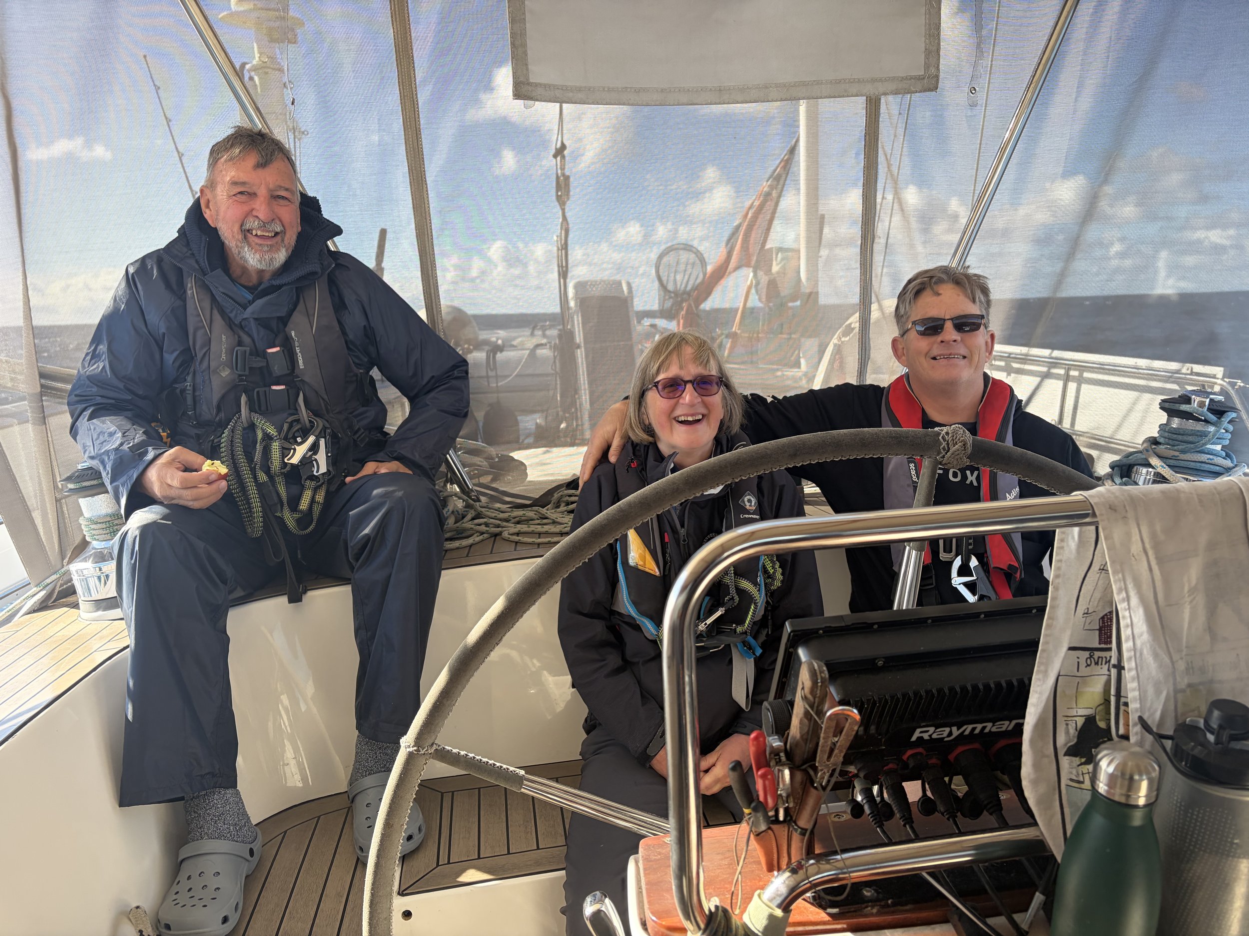
The picture of the day is of a Jenny and John with Robin joining them.
Need/Opportunity Year Three
I am now on the way to Durban and will then head for Cape Town and then on to St Helena, Azores and back to the UK.
I am now in need of 1 additional crew from Cape Town to the Azores. The new crew member would need to be onboard by 10 August and it is likely we would get to the Azores by late September or early October. If at all interested in joining me please contact me on my email below or WhatsApp +44 7931360372.
The blog will continue as we continue the journey. If you have any comments or suggestions about the blog then do email me on hine.nick9@gmail.com