Year 2- 4th October 2025 –Pandang Padang Beach -Boom Marina -Banyuwangi- Java
The alarm went at 5.00am and Mark, Keith, Steve and I got up and Mark put the kettle on. It was dark and I could see the lights of fishing boats offshore. We upped the anchor and headed out of the anchorage passing the catamaran whose occupants appeared to be sound asleep. We had the navigation lights on and the steaming light.
We set a waypoint on the Southeastern part of Bali and headed for it some 42 nm away. We were on gori making 7 kts. We enjoyed our tea which was then followed by a proper coffee. There were quite a few fishing boats we had to watch out for and as the dawn broke they went from just being lights to being visible boats. The sun rose from behind the clouds and it began to heat up. There was little wind and the sea was flat.
We motored on and hoped the wind would come in which it did not really. We came across a number of fishing boats on the way and we saw a number of fish jumping out of sea from time to time. We decided to do 2-hour watches with Steve and I on the first watch. Mark and Ruth on the second and Keith and Janet on the third. Steve and I did the 6-8,00am watch and once this was finished I decided to do scrambled eggs on toast for breakfast which everyone seemed to enjoy.
I did some admin and emails and thought about year 3 and the crew who wanted to join and where etc. I managed to have a rest as well. We motored on and the wind did not really increase so we continued in the right direction. Ruth and Janet made lunch which was nice -guacamole, tomatoes nachos etc.
I had looked ahead and the marina was down a creek. According to the plotter this creek dried out at low water. However, I looked at google maps and google earth and there seemed to be enough water. We also heard from other boats who were going through the channel that there was enough water.
When there was enough wind I thought we should sail for a while whilst we made water. Both tanks were quite low and so we got out the genoa and sailed as vest we could. Due to the current and state of the wind this meant we were only doing 1-2 kts. However, we needed to make water and so we put on the water maker. This took a couple of hours and so we were able to fill one tank. We needed to do this as otherwise we would not have any water.
Once we had filled one tank we put in the genoa and then motored forward. The current was rushing through from the gap between Java and Bali and was probably up to about 3 kts. We decided to head over to the Java side and them to come up the Java East coast and out of the current. We crossed over and initially the current was strong as we crossed bit as we got across it softened and our speed increased.
We eventually came across the East side and motored up this side. There was little current here. We realised that Java time had gone back an hour and so we changed the ships clocks. This helped us as we had an extra hour. Before too long we came to the channel down to the marina. We came down the channel slowly and the lowest depth was about 3.7m. We came to the marina and were asked to moor on the hammerhead. There were a lot of people to greet us including some from the rally.
I had to take all the documents up to the marina office. Whilst we had a good pontoon to moor off there was no electricity. The marina office kindly gave us a coconut to drink. We sorted ourselves out and there was a tour which had been organised to go up the Ijen Crater (a volcano) but this was leaving at 00.30am and would last all night getting back at 9.00am in the morning. None of us could face it today. A party was going off to a Japanese restaurant but we did not fancy that either. We therefore decided to stay and have supper aboard which Keith cooked which was prawns and pasta with broccoli which was delicious.
We decided we will do the Ijen Crater tour tomorrow night. We are also going to do a quad bike tour tomorrow. There is then a welcome dinner and show from 4.00pm tomorrow. We were here as were 5 other boats.
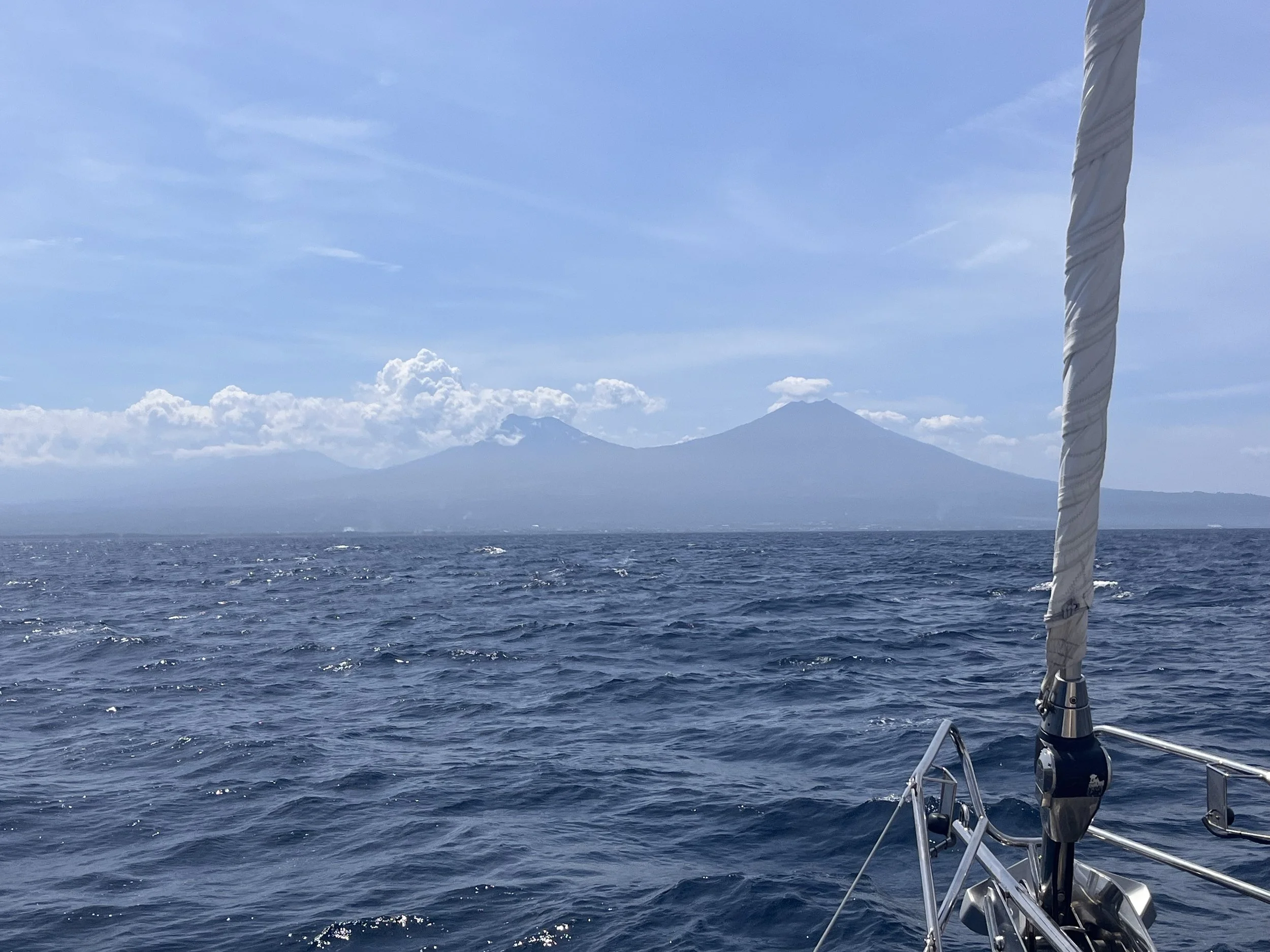
The picture of the day is a picture of the volcanoes as we arrive to Java.
Java is one of the Greater Sunda Islands in Indonesia. It is bordered by the Indian Ocean to the south and the Java Sea (a part of Pacific Ocean) to the north. With a population of 156.9 million people (including Madura) in mid 2024, projected to rise to 158 million at mid 2025, Java is the world's most populous island, home to approximately 56% of the Indonesian population while constituting only 7% of its land area. Indonesia's capital city, Jakarta, is on Java's northwestern coast.
Many of the best-known events in Indonesian history took place on Java. It was the centre of powerful Hindu-Buddhist empires, the Islamic sultanates, and the core of the colonial Dutch East Indies. Java was also the centre of the Indonesian struggle for independence during the 1930s and 1940s. Java dominates Indonesia politically, economically and culturally. Four of Indonesia's eight UNESCO world heritage sites are located in Java.
Java was formed by volcanic eruptions due to geologic subduction of the Australian Plate under the Sunda Plate. It is the 13th largest island in the world and the fifth largest in Indonesia by landmass.
Java lies between Sumatra to the west and Bali to the east. Borneo lies to the north, and Christmas Island is to the south. It is the world's 13th largest island. Java is surrounded by the Java Sea to the north, the Sunda Strait to the west, the Indian Ocean to the south and Bali Strait and Madura Strait in the east.
Java is almost entirely of volcanic origin; it contains 38 mountains forming an east–west spine that have at one time or another been active volcanoes. There are 112 volcanoes in all, 35 of which are active. The highest volcano in Java is Mount Semeru, 3,676 metres (12,060 ft). The most active volcano in Java and also in Indonesia is Mount Merapi, 2,930 metres (9,610 ft). In total, Java has more than 150 mountains. Java's mountains and highlands split the interior into a series of relatively isolated regions suitable for wet-rice cultivation; the rice lands of Java are among the richest in the world. Java was the first place where Indonesian coffee was grown, starting in 1699. Today, coffea arabica is grown on the Ijen Plateau by small-holders and larger plantations.
The Ijen volcano complex is a group of composite volcanoes located on the border between Banyuwangi Regency and Bondowoso Regency of East Java, Indonesia. It is known for its blue fire, acidic crater lake, and labour-intensive sulphur mining.
It is inside an eponymous larger caldera Ijen, which is about 20 kilometres (12 mi) wide. The Gunung Merapi stratovolcano is the highest point of that complex. The name "Gunung Merapi" means 'mountain of fire' in the Indonesian language; Mount Merapi in central Java and Marapi in Sumatra have the same etymology.
Ijen Geopark stretches across the entire regency which is specifically in the Mount Ijen area, Pulau Merah Beach, and Alas Purwo National Park. It has various geological, biological, and cultural sites. It became part of UNESCO Global Geoparks in 2023. The blue fire is ignited sulfuric gas, which emerges from cracks at temperatures up to 600 °C (1,112 °F). The flames can be up to five meters (16 feet) high; some of the gas condenses to liquid and is still ignited. Ijen is the largest blue flame area in the world. Local people refer to it as Api Biru (Blue Fire).
West of Gunung Merapi is the Ijen volcano, which has a one-kilometre-wide (0.62 mi) turquoise-coloured acidic crater lake. The lake is the site of a labour-intensive sulphur mining operation, in which sulphur-laden baskets are carried by hand from the crater floor. The work is paid well considering the cost of living in the area, but is very onerous.[3] Workers earn around US$13 per day and, once out of the crater, still need to carry their loads of sulphur chunks about three kilometres to the nearby Paltuding Valley to get paid.
Many other post-caldera cones and craters are located within the caldera or along its rim. The largest concentration of post-caldera cones runs east–west across the southern side of the caldera. The active crater at Kawah Ijen has a diameter of 722 metres (2,369 ft) and a surface area of 0.41 square kilometres (0.16 sq mi). It is 200 metres (660 ft) deep and has a volume of 36 cubic hectometres (29,000 acre⋅ft).
The lake is recognised as the largest highly acidic crater lake in the world. It is also a source for the river Banyupahit, resulting in highly acidic and metal-enriched river water which has a significant detrimental effect on the downstream river ecosystem.
Need/Opportunity Year Three
In year three I will be going from Thailand to Sri Lanka, India, Maldives and then on to Chagos, Mauritius, Reunion, Cape Town, St Helena, Azores and back to the UK. I am looking for crew from Mauritius/ Reunion Island to Cape Town and from Cape Town to the UK. If of any interest do email me.
The blog will continue as we continue the journey. If you have any comments or suggestions about the blog then do email me on hine.nick9@gmail.com